Day 13: The First and Second Battles of Manassas

Wednesday, June 13 was spent at the site of the First and Second Battles of Manassas.

The First Battle of Manassas, known as the Battle of Bull Run in the North, was the first major conflict of the Civil War. What the Federals and Confederates lacked in experience, they made up in bravado. As the armies began to amassed in Virginia on July 16, 1861, both believed the "war" would be over with the first battle. On July 21, with the nation still romanticizing the idea of war as a Sunday afternoon live drama, civilians came from Washington, DC with picnic baskets to watch the events unfold. However, when the black smoke of the gunpowder faded, there were nearly 5,000 dead and wounded, including the first civilian casualty, Judith Henry, an elderly and infirmed widow, whose farm, Henry Hill, was the scene of much of the fighting.

The batle was a Confederate victory, and the beginning of the worst conflict ever on US soil.  The small town of Manassas began to rebuild, and when summer returned in 1862, so did the war and the second battle of Manassas.

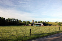
We started the day at the Visitor's Center, with some interesting exhibits,an electronic battlemap and a terrific 45 minute film that gave a lot of information on both battles. We walked the grounds of Henry Hill, which included the restored home of Judith Hill, and the small family cemetery where she is buried. The landscape on and around Henry Hill remains as it was in 1861and 1862 when life was interrupted not only by the battles, but the aftermath as well.

Unlike Shiloh and Vicksburg, the Manassas National Battlefield, specifically the site of Second Manassas, is not a monument park. It is a driving tour in the specific sense, in that you drive from one key location of the battle to the next. There are historical markers, but the site also includes stops at the Brawner Farm, the Stone House, Sudley Church, the unfinished railroad and the Confederate Cemetery.

The driving tour, unlike the monument tour, gives you great insight into the expanse of real estate in the town that was occupied with soldiers, tents and artillery....twice.
Read More

I Know I'm Behind

I know I'm behind.

I owe information on Manassas, the ride to Antietam and the Battlefield at Antietam....but we spent last night exploring downtown Frederick, Maryland, and excellent town, and tonight celebrating (also in Frederick) the last night of our amazing vacation.

We head back to New Jersey tomorrow.. through Gettysburg... and I promise I will catch up with blogs and pictures when we get back.

It truly has been and amazing ride through America and history.
Read More

Day Twelve: Blue Ridge Parkway and on to Manassas

If your coffee doesn't wake you up, starting the day driving directly into the sun on the Blue Ridge Parkway certainly will.

Tuesday was Part Two of our ride on the Blue Ridge Parkway. We'd crossed into Virginia as the end of the day on Monday and would continue to the Parkway's end and on to Manassas. I've come to love riding these byways in the early morning when the day is still quiet and sleepy and the sunlight is streaming through the trees. We were surrounded by the fragrance of new grass and wildflowers and a very different landscape than the one we'd experienced on Monday.

The Blue Ridge Parkway through Virginia is at a lower elevation - 3,000 or more feet lower, so the peaks were less knife-like. The landscape was also different. While we'd seen nary a sign of civilization on Monday, Tuesday's ride offered farms and barns, grazing cows and fields with hayrolls waiting collection, plotted like a farm version of "Connect the Dots".

While we headed to the higher elevations, I could see images of farms flicker through the treeline like an old silent movie. Higher and higher we climbed, until we were literally driving through a cloud. At one point, we could see about five feet in front of us. It was eerie and amazing at the same time.  It cleared from the roadway, but the sky above us was still white, and would stay that way for the duration of the ride.  The clearing was short lived. The temperature flirted with sixty degrees, but it felt much colder on the bike. As we began our descent, we ran into it again, a thick misting on the road and the ridge, but the white surrounded us beyond the trees on the mountainside. The first overlook sign I could actually see put us at Petite's Gap, an elevation of 2361 feet.

It wasn't until mile marker 72 that we broke through the second round of cloud riding. The clouds had cleared the road, but still clung stubbornly to the valleys and divides on the peaks to our right. It didn't feel like we'd actually left the heavens until our pit stop for gas at Big Island on Route 501. You could smell the grease from whatever they were frying at the Mountainview Restaurant, so we passed on that establishment for lunch, snacking on our stash of raisins and almonds instead.

We continued back on the Parkway until the end, and then onto Skyline Drive through Shenandoah Valley National Park. Unfortunately, the combination of cloud cover and altitude forced us to stop and suit up with rain gear, in part to keep warm, and to prepare for the rain that threatened.

Luckily the rain held off and we made it to Manassas without incident. It had been the longest ride of the trip - eleven hours - and we were exhausted.  Our energy level piqued as we rode past the entrance to the Manassas National Battlefield on the way to our hotel. It propelled us through dinner, but we were both asleep by 9:00pm.

The Blue Ridge Parkway was an amazing ride, and an experience we won't soon forget.
Read More

Day Eleven: The Ride through the Blue Ridge Mountains

Sorry for the delay... the network was down at our hotel in Manassas, so I'm a bit behind....

We left Cherokee, NC on Monday and began our two day trek through the Blue Ridge Mountains. One of the first signs I saw when we entered the Blue Ridge Parkway read, "CAUTION: Steep, winding mountain road next 35 miles." My stomach pit, lurched and I took a huge deep breath.

There are numerous overlooks all along the parkway - perfect photo opportunities - including the highest spot on the parkway at 6053 ft. I did most of my clicking from the back of the bike with great results.


As we climbed higher and higher, the word of the day was undoubtedly "wow", often spoken in an awe-inspired hush as we  gasped at the majesty of the sites we saw. At one point, near Craggy Ridge, the entire mountain was enveloped in a cloud, a palette of grays and whites with ghostly wisps dancing across the roadway. It was like riding in a dream.

To the left, the sky behind the towering evergreens was as white as snow. To the right, as we neared and rounded the curve, it was a tranquil blue, and changed again as we rode around the next bend. The constant change was amazing.

We had lunch at Mount Mitchell State Park (elevation 6,684). As we sat, we watched the entire mountain disappear into the fog before our eyes. It rained for about five minutes and then the mountain began to slowly fade back into view. It was like watching a nature movie over lunch.

The Blue Ridge Parkway is one of the favorite rides of motorcycle enthusiasts, and was the ride Jason was waiting to do on this trip. The postcard we got for Zander was a vintage 40's style illustration of a motorcyclist riding on the Parkway. There were SO MANY bikes on the ride! It was very cool to see.  One of the very cool things about bikers is that they salute each other as they pass... a wave, a few fingers, a head nod. Regardless of what state,road, highway or byway we've travelled, that is a constant.

The day ended in a small Virginia town named Galax. Leveraging Jason's affection for Star Wars, I referred to it as "A Galax far, far away....."  It got more than a few chuckles.

We had dinner at a local restaurant called Macabos which featured an amazing menu of really cool sandwiches, burgers and the like. We each had a dinner named appropriately for our personalities. Jason had "The Lone Ranger", a corned beef, hot pastrami, melted swiss and cole slaw on an everything bagel. He said it was great. For me, it was the "Ricochet Rabbit" - since Jason says that's who I remind him of when I wake up ready to bing bing bing go first thing in the morning - turkey, swiss, chicken breast, lettuce, tomato and mayo on a plain bagel. Also terrific.

After dinner, it was back to the hotel for a good night sleep and Day Two of the Blue Ridge in the morning.
Read More

They Certainly Can Cook in the South

I know these are late posts, but now that I've got a bit of downtime, I wanted to catch up.

The South is famous for hospitality and food. We've experience both on our journey.

In Pickwick Dam, Tennessee, we had dinner at a place called Freddy T's. The atmosphere was a bit like Margaritaville Meets Pirates of the Caribbean. It was quirky and fun, and the food (and margaritas) quite good.

Our second dinner in Pickwick Dam was at John's Pier.  Now, I love shrimp any way you cook them, but peel and eat are my favorite. These were the BEST I've had in a very, very long time. Plump, fresh and with a kick-a** cocktail sauce for dipping, I could have eaten more and called it dinner. But for dinner I had a great smothered chicken, and Jason had Chicken Cordon Pier, their version of chicken cordon bleu.  If you're ever in Pickwick Dam, Tennessee, either place is a winner.

On both Day Seven and Day Eight, we went to Duff's Tavern and Grille, located on the 1300 block of Washington Street in Vicksburg. 

For lunch, I had red beans and rice with chorizo sausage and the best gumbo I've had since New Orleans, so good, in fact that I had it again for dinner on Friday! Jason and I also shared some fried pickles...yes, fried pickles. We'd seen them on several menus in the past few days, we just had to try them. The batter was a southern fried chicken batter, and they came heaped on a plate with a side of ranch dressing, Excellent!  Jason had a filet and shrimp scampi in a butter and garlic sauce so good, I had to write about it. I had a pecan crusted catfish with a brown butter sauces and for dessert, a pecan bread pudding with a Jack Daniels sauce, served warm with just enough cream dripping over top. It was so good, it was indecent!!!

A quick ride from the National Monument Park, Duff's is a definite winner!!
Read More

Riding with the King

As part of our  our ride today, we cruised along Route 53 in Pickens County, Georgia. We had Eric Clapton and BB King's "Riding with the King" jamming on the iPod. We stopped at a BP gas station for water and a break and found three friends standing in front, having a conversation. One looked vaguely familiar.

When I walked past, I nodded in their direction and said, "Gents", which prompted a nod and "Ma'am" in response.  That was quickly followed by a laugh by one about how he simply loved to hear a woman use the word gentlemen, and it was something he hadn't been called in quite a while.

When I came out of the store, I asked if they wouldn't mind letting me take their picture, and they gladly obliged. That led to a chat about our trip, and Gary telling us he'd just been in Tupelo, Mississippi for an Elvis impersonator contest.  Guess which one is Gary!!  The guys were great and gave us a shortcut to Route 5 and 515, which saved us considerable time.

So here you are guys!!  I hope you get to see this and show your friends!

Randy, I'll mail the picture to you when we get back to New Jersey, as promised!!
Read More

From Tara to TeePees

We crossed into Georgia in short order on Sunday, June 12,  however shortly into our drive, our trip was waylaid by a group of bikers - the Lance Armstrong kind. We waited for nearly a half hour in Troup County while literally hundreds of bikers sped past participating in what was clearly some sort of race. They passed in groups and they passed as stragglers, but they passed, and passed and passed.

Men and women. Young and not as young. Fit and, well..let's just suffice to say spandex is not a forgiving fabric.

Once on our way, we rode through LaGrange, Georgia and over the Chattahoochee River of country music fame. Sadly, while I hoped to see some antebellum plantations, like Gone With the Wind's "Tara", I was out of luck. I snapped pictures of a few beautiful homes in LaGrange, but nor much after that, at least on the route we were traveling.

The ride along Route 53 in Pickens County was scenic, and we saw almost as many bikes as cars. Curiously, we passed quite a number of houses with huge collections - no, I can't even use the word "collections" because that would infer that there was a rhyme, reason or plan - with more than their fare share of cars parked, stalled or forgotten in their front yards. They were all makes, models and years, and in various stages of disassembly and rust.  Hard as I try, I can't fathom a reason, but if you're looking for a car to restore...or parts... or an interesting lawn ornament for your own front yard, traverse Route 53.

Now we've been below the Mason-Dixon line for a week now, and when you've spent that much time in the south, at some point, you have to eat barbecue. Today was our day and it was in a class by itself. The yellow house on the side of the hill was enough to attract our attention, but the hundreds, maybe even a thousand pig signs, painted by "Oscar Pig-casso", was just beyond description.

Colonel Poole's  Bar-B-Q in East Ellijay, Georgia, is a local wonder. Not only was the bbq delicious, the place was definitely entertaining. We met one of the Colonel's sons, who was pleasant as pie, and funny to boot. He took our order and gave us some history of the Colonel and the BBQ. You can read more about them at their website. It's a hoot. Or in this case, an oink!

We crossed into North Carolina in the late afternoon and the began our ride towards the Great Smoky  National Forest. The ride  up the mountain was spectacular. Around nearly every curve was another breathtaking view, and talk about bikes! We saw tons.

Cherokee, North Carolina was our end point for the night, and to our surprise, we found not a Harley dealer, but a Harley store - Cherokee Harley. More tee shirts! At this rate, my Harley shirts are going to outnumber my Mets attire!!

Tomorrow we continue through the Great Smoky Mountains on our way to Virginia.

Stay tuned.
Read More

The Charge Across Mississippi and Alabama

When we stepped outside the hotel into the Mississippi sunshine, the heat and humidity enveloped us like a second skin. You could feel the moisture in the air, and it hung as thick as molasses.
We left Vicksburg on Saturday morning at 7:15am and began Brock's Charge across Mississippi and Alabama. Our goal - the Georgia state line.

The objectives for the day included two Harley dealers. We arrived at the first,in Jackson, credit cards at the ready, to find that we were too early. It was only 8:15 am and they didn't open until nine. We discussed waiting, but the conversation didn't last long. The heat and humidity remained our enemy, and standing still for any period of time was just not an  option. 

Our next stop was Meridian, Mississippi.

It was the first day that we started out heading east, and the sun burn hot an white in front of us. Opportunities for photos were scant - the sun was literally in my eyes - and the landscape on Route 20 lacked appeal.

Once in Meridian, we pulled into the parking lot of Chunky River Harley Davidson. Dozens of bikes and bikers in assorted sizes, shapes and colors milled about the parking lot as they were preparing for a Soldiers for Soldiers ride. Every Harley dealer we've been to has had some sort of sign or banner in support of our troops, which I find quite impressive. So, if you know someone who has served, or is on active duty, tell them thanks!!  (Thanks, Jarrod!  Thanks, Joey!!)

Tee shirts in hand, we headed out of Mississippi and into Alabama. As we crossed the state line, Alabama spread out before us in an undefined pattern of  pine trees, thickets of gnarled brush, planted farms and brown fields.  The clouds rolled by in a celestial parade of soft white cotton, quite the illusion as the humidity raged on.

In Selma, we began the Lunch Lottery and rolled the dice on Southern Girls, a small diner on Route 22 east. We were greeted and treated with all the Southern hospitality one would expect to find in Alabama. Lunch was great. Jason had a fried bologna sandwich, the first time we'd seen that on a menu, and I had their version of  a tuna melt - tuna and cheese on toasted wheat bread.  Throw in a side of cheese fries, and a pepsi and lemonade to wash it down, and we had another great lunch.  Thanks, Southern Girls!!

The rest of the ride was relatively uneventful. As we got closer to our final destination for the evening, Lanett Alabama, we got a bonus. I spied a huge billboard for Big Swamp Harley Davidson on Route 85, the same route we needed for our hotel.  We took the exit and pulled into the parking lot.  Big Swamp is located in Opelika, Alabama, and we were told by the girls there that "Big Swamp" wasn't just a cool country  sounding name for the dealership. Opelika is actually a local Indian word that means Big Swamp. The bonus Harley round was a success. Not only did we get new tee shirts (I was finally able to find the pink HD shirt in my size. The purchase contributes to the fight against breast cancer), but jason was able to get his iPod holder and his Harley Road Atlas, which, inc addition to maps, it identifies scenic, twistie and sweeper roads recommended for riders, and of course, the location of every Harley dealer in the continental US.

Dinner, on the recommendation of the hotel staff, was at Milano's, and Italian restaurant "just down the road a piece".

Another good meal, another good day.

Now it's on to Cherokee, North Carolina.  Talk to you then!!
Read More

Day Eight: Vicksburg National Monument Park

Vicksburg was more than just a battle - it was a siege - a military waiting game, and marked a critical turning point in the course of the Civil War.

Control of the city was crucial, as Vicksburg was considered a defensive position on the Mississippi River. In May 1862, Confederate general Martin Luther Smith began to fortify the city. It was soon protected by 172 mounted guns forming a ring around the city.

President Lincoln believed the war could not be won without Vicksburg, and in October 1862, Major General US Grant and LT. General John C. Pemberton began their strategic maneuvering for the city.

In March 1863, grant started his army out and in May  waged several battles in Mississippi on his way to Vicksburg, defeating Pemberton's Army of Vicksburg near Port Gibson, Raymond and Jackson, the state capital. On May 16, 1863 he defeated Pemberton at Champion Hill in the bloodiest battle of the campaign, and on May 18, he set his site on Vicksburg.

Grant launched two attacks - May 19 and again on May 22. Both failed to breach the significant Confederate works. Grant called off the attacks and determined to take the city be siege.

Grant's army held the Confederates in Vicksburg, creating mines and shelling their positions on land and using gunboats from the river. On July 4, 1863, after 46 days under siege, Pemberton finally surrendered.

The Monument Park contains over 1600 monuments to the troops that fought on the hallowed ground that is Vicksburg. The landscape is as it was when the battle was waged, except for the trees, which were planted by the Civilian Conservation Corps in the 1930's to help prevent erosion. Cannons are everywhere - and while many are not the artillery used in the battle, they were all used at some time during the war.

Also at Vicksburg is the largest National Military Cemetery of Union dead, and the USS Cairo, the first gunboat sunk by torpedo. It sunk in 12 minutes of December 12, 1862 in the Yazoo River. No lives were lost. The vessel, and thousands of artifacts were  recovered from the river, and are on display.

I wasn't aware of the enormity of the site, or the vast number of casualties. The auto tour is 16  (yes.. 16) miles around the 1800 acre battlefield. Before we started out, Jason and I bought the Vicksburg Expedition Guide by TravelBrains - a two and a half hour audio tour of the battle and the park. Like in Shiloh, it brought the sounds of the battle and the voices of those who witnessed it to life.

If you get to Vicksburg, plan at least two days. We did the battlefield tour in a full day, (and a two hour preview yesterday) which left no time for the Confederate Cemetery (Soldier's Rest, a few miles away), the Old Courthouse Museum, which was built in 1858 and survived the war with minimal damage, the Martha Vick house, built for the unmarried daughter of the city's founder, Newit Vick, and a host of other antebellum mansions and non-military attractions, like the Biedenharn Coca-Cola Museum.

Another successful day on the Civil War Harley tour.

Jason needs the computer to chart tomorrow's route across Mississippi and Alabama, so look for the Vicksburg pictures on Saturday.
Read More

Traveling the Natchez Trace Parkway

The Natchez Trace Parkway takes you on a nearly 450 mile scenic drive from Tennessee through Alabama and Mississippi. There are thousands of years of history marked along the way.

In our journey, we've done two stints on the Natchez; first from Franklin, Tennessee down to Shiloh and then yesterday from Shiloh to Vicksburg.  We had perfect weather both days; a beautiful, serene, green ride past a diverse terrain of rivers and rolling hills.

In the 1800's, the Trace was frequented by boatmen and farmers who floated their goods and supplies down to ports in Natchez and New Orleans. Traces of the old route have been preserved and can be seen along the way.

But the area has a history even older than that. It ran through the heart of Choctaw and Chickasaw country, and we saw several old Indian burial mounds along the way. In Mississippi, there was a stop for the Phaar Mounds, the oldest archaelogical find in the state (1966).   The mounds appeared to have been burial mounds built somewhere between 1 and 200 AD. Our stop at the Merriweather Lewis burial site was also on the Trace.

The traffic was minimal. In fact, it was non-existant. For miles at a time, we were the only ones on the road.  You can see glimpses of farms through the treelines, and every once in a while, it opens up to a wide expanse of land - a plowed farm with its green plants beginning to emerge, a magnolia tree in the midst of a field, some wandering cows. We passed the Tennessee River and stopped at the Reservoir Overlook, a 50 square mile reservoir made from an earth filled dam.

It's a great bike route, but I don't know that I'd chance long distances in a car. It's a loooooooooooooooong was between gas stations if you don't know the area. We logged almost 300 miles on the Trace during our journey. If you've got a bike, and are looking for a sweet ride, this is definitely something to look at!
Read More

The Ride to Vicksburg

We made it to Vicksburg earlier today, and the battlefield is literally across the street from our hotel. I'm so excited.

We took a quick loop... quick isn't exactly the word.. it took an hour with only two stops.. just to get the lay of the land.

I've loaded a bunch of pictures and will tell all about the ride here and the Natchez Trace Parkway tomorrow.

It's going to be an amazing day!
Read More

The Battle of Shiloh

Today was the first day that we were stationary - no where to go except the battlefield. Despite weather reports of area thunderstorms, the skies over Pickwick Dam, Tennessee looked blue, so we headed to Shiloh National Military Park.

As we pulled in, past several monuments to the troops that fought here and markers that identified who was where and when, I was stunned at the enormity of the land that was the battlefield. For two days in April 1862, the Federal Army battled the Confederates, with Major General Ulysses S.  Grant and Albert S. Johnston each in command.

We began at the visitor's center, where a 30 minute film and exhibits introduced us to the battle. A stop in the bookstore was next, where we purchased the auto tour cd, which navigated us around the battlefield detailing the chronology of the two day battle.

The first shots were fired on April 6, 1862 at 4:55am as Confederate pickets engaged a Union patrol. The Confederates launched a massive, unexpected assault that General Prentiss' division was unable to stop. They were overrun by 9:00am and many of the Union survivors fled.

Later in the morning, three Union divisions occupied an oak thicket for seven hours against repeated Confederate attacks. One soldier described the bullets whizzing by like angry hornets, and the area was to become known as the Hornet's Nest. During the battle, General William Wallace was killed and Prentiss, along with over 2200 Federal troops, was captured.

The federal troops withdrew further north and eventually made a fighting retreat to Pittsburg Landing on the Tennessee river. 

While the Confederates continued their assault on the Hornet's Nest, which they eventually surrounded and captured, Grant was able to prepare a last line of defense to the north. That night, General Don Carlos Buell and his Army of the Ohio landed with reinforcements for Grant. A counterattack by the Union army at dawn, 50,000 troops strong, eventually forced General Beauregard, who took command with the death of General Johnston, to withdraw.

Casualties were numerous on both sides - almost 11,000 for the federal Army of the Tennessee, over 2100 for the Army of the Ohio and nearly 11,000 for the Confederate Army of the Mississippi . After the battle, federal troops buried the dead from both sides near where the fell. In 1866, the US Government established a national cemetery for the Union soldiers killed at Shiloh. They were disinterred from the mass graves on the battlefield and reinterred in the National Cemetery at Shiloh. The Confederates remained in five mass graves. Thirty-five thousand soldiers are buried here; two-thirds are unknown.

We spent the entire day at Shiloh, and could have spent more time if we had it. The experience was amazing. You were able to actually see where the troops were camped, where generals fell and where cannons were pointed.  At one point in the battle at the Hornet's Nest, General Ruggles brought the cannons from all the southern batteries to bombard the Union forces. Fifty two cannons are there, pointed in the same direction they were nearly 150 years ago. It was an unbelievable sight... and these guns were silent. I can't even imagine what the Union troops felt, seeing that intense level of artillery pointed at them.

If you have the chance to visit Shiloh, do it. The auto tour cd brought it to all to life, and the cemetery...those rows and rows of stoic white headstones, was a somber reminder of the lives that were lost.
Read More

The Battle of Franklin

The bloodiest battle no one one has ever heard about.

That's how the Battle of Franklin is best described. I'd never heard of the battle either, until I read the book, "Widow of the South", a work of historical fiction based on the Battle of Franklin.

In 1864, Franklin, Tennessee was a community of less than 800 people. It wasn't a Confederate stronghold or a strategic location for the Union, even though Federal troops had occupied the town since 1862. Yet, in November 1864, 40,000 troops amassed here and when the fighting ceased, a mere five hours later, over 9,000 men were killed, wounded, captured or missing, and 80 percent of the casualties wore gray. Six Confederate brigader generals lost their lives that day, the largest loss of its kind during the entire war. The Battle of Franklin was the last offensive launched by the Confederates, and devestated the Army of Tennessee.

The battle affected everyone in town, especially the Carter and McGavock families.

Fountain Branch Carter, a native Virginian, moved to Tennessee as a young boy. He and his wife Mary  built the Federal style house in Franklin and had twelve children. His house, farm and holdings grew, and in 1860, Carter's net worth was $62,000. In 1861, when the war broke out, his three sons, Francis, Moscow and Tod all joined the Confederate army.  On the evening of Novmber 30, 1864, Carter's home would become the center of the battle etween the Union forces led by General John Schofield and the Rebel army commanded by General John Bell Hood.

The fighting began at 4:00 pm with a massive frontal assault by Hood. Twenty-eight members of the Carter family and neighbors were huddled in the home's basement as the fighting raged around them. When the family emerged the next morning, they were horrified at the carnage and the bodies of the dead and dying on their porch and heaped in piles on their land.

Carter's son Tod, a captain with the 20th Tennessee, was mortally shot less than 200 yards from the family home. He was found on the field the next day, with eight wounds to his body and a bullet lodged in his brain over his left eye. He died in the family home on December 2, 1864.   The ravages of the war can still be seen on the Carter farm; F.B. Carter's bullet-riddled office building and back porch, including a hole left by cannon fire.

The McGavock family, John, Carrie and their children also found themselves immersed in the effects of the Battle of Franklin.  Their home, Carnton, was commandeered as a field hospital for the Confederacy. Over 300 dead and dying soldiers were in their home and on their lands. Bloodstains are still evident on the floors. The bodies of four of the dead Confederate generals were laid out on the back porch to allow the soldiers to pay their respects.

In 1866, John and Carrie donated two acres of their land to be used as a cemetery for the Confederate soliders who had fallen. The McGavock Cemetery contains the remains of nearly 1500 soldiers. Carrie McGavock orgaized the cemetery by state and kept a record of of all the soldiers interred there, even though many were unknown. Carrie maintained the cemetery until her death in 1905. It is still maintained today.

Both Jason and I were intrigued and inspired by what we learned during our stay in Franklin and would encourage everyone with any interest in the Civil War or historic preservation efforts to learn more about these families and their role in the Battle of Franklin.

Our guide at The Carter House, Alan Corry, was amazing. He spoke with such passion and expertise about the events that led up to the battle, the horrific five hours of fighting, and the families it affected.  He made the battle come alive for us, and we left with a new appreciation for the sacrifices Americans on both sides made that day.

I left Franklin begrudgingly, knowing there was so much more that I wanted to know, so many more questions I had to ask and have answered, but it was time and we were soon on the road our next destination, Shiloh.

To learn more about the Battle of Franklin, the Carters and the McGavock's, check out the following websites:
- Historic Carnton Plantation
- The Carter House
Read More

Why Don't Men Ask for Directions?

It's the question women have been asking since the dawn of time, and I found myself asking it...repeatedly... as we headed unassumingly into Nashville in search of the Harley Davidson dealer we thought might be there.

As we got closer and closer to the city...yes...it is a city....I questioned (silently) the sanity of the decision.

It didn't take long before Jason also questioned the quest, and decided we needed to get out of Dodge, er.. Nashville. Now, while I would have retraced our route into the city, perhaps a tactic oversimplified, this was not the direction my husband chose.  He crabbed and hrrumphed our way for 20 minutes, then muttered something about needing a gas station. When we found one a few block later, he filled the bike with gas, bought a map and sat about 20 feet away from me.  I watched him turn and shift the map for a good five minutes before folding it and walking back triumphantly, announcing, "We're heading int he right direction. I just need to make a left."

At some point wee were able to make our way out of Nashville and on towards Cool Springs, where the hotel was located. Next challenge... we can't find the hotel.  When we got to the end of the road (which was a few miles long) he said it was on, he hrrumphed again and we pulled into a CVS.  I asked if he was going to call the hotel and ask for directions. I was, of course, told no. I went into the CVS, since I needed more sun screen. At the register, I asked the cashier if she knew where the hotel was. She must have read the exasperation on my face, because she shook her head sympathetically and asked, "Husband won't stop for directions?" I couldn't help but smile.

She sent us back in the direction we'd come from, and said we really weren't far. And she was right. The hotel was about a mile back...a right turn off the road it was supposedly on.

So, why am I blogging this story? I hadn't planned to tell it, as it didn't have any real significance to our trip, other than validating, once again, that men never ask for directions.  After leaving the CVS on the way to the hotel Jason says, "wow... do you see that sign?" "What sign?" I ask as there were many on the horizon.  "The Harley sign," he chirps.

The Harley Davidson dealer we went looking for was across the street from our hotel.

Unbelievable.
Read More

Day Four: On to Tennessee

Monday greeted us with perfectly blue skies, a welcomed sight after the gray skies of Saturday and Sunday.  The ride itself was probably the best of the vacation to date - the landscape, the roads, the weather (not a drop of rain!!). 

It was another early start, as we were on the road by 7:30am.There were stretches along the way where we had the road completely to ourselves. The sun got brighter, the skies bluer and the day stretched out before us as we continued through Kentucky on to Tennessee.

A lot of the ride has been through mountain roads, past hillsides dotted with grazing cows.  I continue to be amazed at the barns we pass; clustered as outbuildings on a farm or standing sentry in an unused field. They stand on farmlands and curiously, next to new homes, perhaps a quiet reminder of days gone by. As we moved further west in the state, the hills still rolled, and they were still beautiful, but they didn't have the majesty of what we'd seen in Winchester or Lexington.

We have also been through dozens of small "Main street" towns.  More often than not, the street we ride on is called Main Street. They are perfectly nostalgic and wonderfully patriotic, with American flags flying proudly on homes and storefronts. Historic Lebanon, KY, as the town was promoted when you arrived, was one of those. Another was Greensburg, which boasted its Courthouse as the oldest public building (c. 1802) still standing in Kentucky.

The first landscape we saw when crossing into Tennessee didn't look much different than what we'd seen in Kentucky. Lunch was at the Snow White Drive Inn on the outskirts of Lebanon, Tennessee (not to be confused with Lebanon, Kentucky). It was a diner right out of a 1950's movie, complete with red lacquered chairs, formica tables, and vintage signs for Coca-cola.  Of course, being in Tennessee, there was the requisite Elvis Presley poster hung in a place of honor.

This was Americana at its finest! The menu offered a stunning array of hot dogs, hamburgers and "Pig Packs", pork barbecue and the fixins' to feed 4, 6 or 10 of your closest friends and family. I played it safe with a grilled chicken sandwich and s side of french fried with brown gravy. Jason lived on the wild side and ordered "The Big Dog" (seems perfect for him....), a foot long hot dog slathered with mustard, onions, chili, cheese and topped with cole slaw. This thing was enormous! While I would never have imagined cole slaw on a hot dog...or a hot dog you needed to eat with a knife and fork, he said it was really good and ate the entire thing.  I'll admit my chicken sandwich was quite tasty and the fries and gravy were divine.

We asked the waitress for directions to Route 255, but she didn't know, so she kindly asked the Sheriff, who had just wandered in for lunch. He came over to our table and asked, "Where ya'll  headed?" Jason explained.

"Hmmm..." he pondered. "Is that your bike out there?" he asked, nodding his head in the direction of the Harley. We told him it was and he scratched his head and told us to "di-rectly follow Route 70 right out here into Nashville, the State Capital."

Yep. he put it just like that in a southern drawl that just dripped.

And so we headed to Nashville.

As we rode, we remembered there was a Harley dealer in Tennessee, and we thought it was Nashville. So as we approached the intersection for Route 255, Jason decided we would go in search of new tee shirts for the collection. Mind you...we THOUGHT it was in Nashville..... needless to say, we spent an hour in traffic, no Harley dealer, no teeshirts.

On to our hotel and Franklin, Tennessee.
Read More

The Battle of Perryville

When one thinks of Civil War battles, the state of Kentucky is not one that readily springs to mind.  When we arrived in Danville yesterday (yes, I'm a day behind), I leaped through the Guest Services Guide and under Area Attractions was information on the Battle of Perryville. Since the battlefield was a scant 12 miles form our hotel, we jumped back on the bike and roared off.

The Battle of Perryville was the last battle fought on Kentucky soil. During the summer of 1862, General Bragg's army invaded Kentucky and after maneuvering for more than a month, pushed the Confederates into Perrysville. In October 1862 and the Confederates planned an attack, but had no idea that their 16,000 troops would face more than 58,000 Union soldiers.

The battle went on for five hours, beginning at around 2:00 pm on October 8. When it was over, more that 7,500 Union and Confederate soldiers had been killed, wounded, or were missing.

We walked the battlefield, which had been the farm of Kentuckian Harry Brown.The rolling hills of Kentucky played as much a part in the battle as the soldiers themselves. The Union soldiers positioned themselves on ridge after ridge on the Brown farm. Even when the Confederates charged and forced the Federal troops from Parson's Ridge, there was always another ridge to fall back to. We stood where the cannons fired mercilessly into the oncoming soldiers and could see just what they saw.. the oncoming soldiers armed with guns and attitude, relentlessly attacking. We also saw the Confederate perspective, and could only imagine what the shelling was like.

The thing that resonated with both Jason and I was the interpretive sign on Starkweather's Hill. Starkweather's men were the last stronghold between the Confederates and the Union wagons with supplies and ammunition. The hill was manned with twelve cannon, but the Confederates regrouped and charged the hill two more times. The sign said that during the hand to hand combat, the hill and the ground became slippery with the blood that was shed. 

The Federal soldiers were eventually driven off the ridge.

Neither side was able to claim a definitive victory, and the Battle of Perryville was the last of the Civil War fought in Kentucky.
Read More

The Bluegrass State

Our day started early this morning. By 7:15 we were on the bike and riding west. (The vim and vigor I had at 3:00 today is rapidly fading.) The skies in West Virginia didn't look every promising as we rolled out on today's journey to Kentucky, but I kept my fingers crossed that it was simply early morning haze.

When we crossed into Virginia and coal country the skies kept changing from blue to grey (hey..very Civil War-like, huh?) and I continued to keep my fingers crossed. We crossed into Kentucky at 9:00am to clear blue skies and a warm, welcoming sunshine, but alas, the splendidness of the day was soon to fade.

We saw signs for Pikesville Harley Davidson and took the exit, hoping to add to our shirt collection. Alas, we were thwarted, as it isn't open on Sunday. Disappointed, but undaunted, we continued on.

Mountain Parkway, otherwise known as Route 460, was the major through fare for us today, but by 11:30, the skies over Kentucky turned on us and down came the rain. it was nothing more than annoying sprinkles, but the sky was too foreboding to take a chance. We found a place to pull off and put on th raingear. Jason and I looked quizzically at the sky, and then each other, for in that brief moment, the sky was once again blue. Before Jason would say, "Maybe it isn't going to rain," we got pelleted with drops the size of nickels and scrambled to get our rain gear on.  A necessary evil, it kep us dry through the rain and the tempermental sky.  The big ugly cloud was seconds in the distance when it hit us. Driving, cold rain. While it seemed much longer, the brunt of it lasted only 5 minutes, but it continued to rain for quite some time.

We saw signs for Middle Creek National Battlefield, located in Prestonburg, KY. Since the rain had abated, we decided to take a small detour and check it out. In the grand scheme of Civil War battles and battlefields, this one was a skirmish - a two to one ratio of Union troops outnumbered by Confederate troops - just over 3,000 in all.  The battle was fought January 10, 1862 on land owned by Henry Clay Fitzpatrick and was an example of the typical  Kentuckian versus Kentuckian battles in the region. We took a quick look, but the skies had started to look ominous again, so I had to be satisfied with pictures of the interpretive markers to read later.

Around 1:00, we pulled into a gas station in Westchester, Kentucky. The skies were picture perfect and the rain gear was history. When I commented on how great the clover smelled, Jason replied, "That isn't clover you smell, Honey. That's money."  We were in Horse Farm Country. It was farm after beautiful farm, with quietly rolling hills, fences, unassuming horses and larger than life plantation style homes.

I knew he was right when the Mazerati pulled upto the pump behind us.

We continued onthrough Westchester and into Lexington, the first "real" city we'd seen since leaving New Jersey. My expectation going into Kentucky was that we'd see landscape and homes similar to those we'd seen all across West Virginia.  I couldn't have been further from the truth. Kentucky, at least wher we'd ridden, was breathtakingly beautiful.

As noted earlier, we had lunch in Daville and then headed off to our hotel.  While leaping through the guest services guide, I saw information on the Perryville Battlefield State Historic site that piqued my interest. It was only 12 miles from the hotel, so we decided to check it out.

More later....
Read More

Live from Danville, Kentucky

I'm coming to you live from today's winner in the Local Fare Lunch Raffle... a great little place called "The Hub" in Historic downtown Danville.  It's been a long ride again today...,not as long as yesterday.. and definitely not as wet, but we did have to dodge a few...well, more than a few... raindrops.

So last night I crashed and burned after a day of deluge. We got soaked on three separate occasions, but we made the most of our soakings and chalked it up to the experience, but certainly not one I'd relish day after day. We didn't see the sun or blue skies until 5:00pm, but the last few hours of the ride were worth it. 

While it was challenging to really appreciate it through rain speckled goggles, the landscape in West Virginia, along Route 219 where we spent the majority of the day, was full of natural beauty.We were traveling along was what essentially a road cut through the mountains, in Appalachia, with miles of forest interrupted by gorgeous farms and the most unnnatural collection of residences I've ever seen cobbled together. Farmhouses with collections of outbuildings in every size and shape, residences built of brick with  beautifully manicured laws, and trailer home after trailer home - some neat and tidy, and others that looked inhabitable, except that there were cars and trucks, and the occasion Harley parked outside them. They wre interdispersed without rhyme, reason or design, which made me all the more curious to know why someone would build a beautiful two story brick home next to Sanford and Son.

The farms, once there were seemingly nothing but farms, went on for acres and acres, with cows meandering in small clusters or larger herds, with no cares in their worlds.

Jason is getting very adept at manuevering the "sweepers"... long stretches of road with lots and lots of curves...becuase we've been on quite a few of them. Normally I am unphased, looking at the landscape and for the next photo opp, except for the one time I looked to my right and saw how close we were "sweeping" to a gizillion foot drop! Okay, maybe I'm exaggerating a bit, but it was a long, looooooooooooong way down.

Lunch is here, so I'm going to eat. Will be back later tonight with yesterday's pictures and today's tale of adventure.
Read More

Day Two: Wet and Wild West Virginia

It's 11:00pm EST and we're exhausted. We left Gettysburg at 8:30am and got to Princeton, West Virgina 12 hours later. Not because it was twelve hours of driving time, but we had several rain delays, and unlike yesterday, not a bar in sight.

It was cloudy and overcast when we left Gettysburg, but not before an emergency stop at the Gettysburg's National Monument Park Visitor's Center. We had planned to send our 6 year old grandson, Zander, a post card each day, and we forgot to get one when we arrived on Friday. The side benefit was a brief  ride through Monument Park, and another reminder of my promised 4 day weekend. : )

We experienced our first rain, sprinkles really, outside of  Chambersburg. It was annoying more than anything else, but if forced us to don denim jackets.  It was on Route 9 that we had the first soaking rain. Luckilly, Jason spied a picnic bench with a covered area and we pulled in, bike and all. We sat for 45 minutes before deciding it was time to break out the unattractive rain gear and forge on.  I laughed and said we'd probably get two miles down the road and find nothing but sunshine ahead of us.

Boy, was I wrong....

And boy, am I tired.  I'll finish this Tale of Three Deluges in the morning.
Read More

Day One: Gettysburg

What a great start to the vacation! We headed out Route 57 and had our first offensive smell...skunk.. before we got out of Hackettstown!! One thing about being on the bike.. there's no place to hide from nature's fragrances. We had the iPod blasting tunes, and we sang alongwith the songs, happy to be on the bike and on our way to stop one, Gettysburg, PA.

Keeping with our promise to savor the local fare, we passed on a pizza parlor and had lunch at 501 Grill and Tavern in Mt. Aetna. Good food, nice atmosphere. Nothing out of the ordinary....well, except the cook, and she was, well, interesting, to say the least.

There was some tough traffic on day one. We hit our first snag on PA 501. We were surrounded by beautiful PA farmland, terrific old barns, cows in the fields, beautifully manicured, green farms - all great scenes of Americana, but simply sitting on the bike is tough on a hot and humid day. Our second snag was in on Route 30 in York, PA, interestingly, right outside the Harley factory where they build Electra Glides. The traffic was bad enough on it own, but it also happened to be quitting time at the Harley factory. All kinds of bikes came roaring out of the parking lot onto Route 30, and despite the extra traffic, it was actually very cool.

As we crept along, a young man on a customized black Harley pulled up along side us. We struck up an excellent conversation with him as we moved along.. stopped.. moved along and stopped for about 5 miles. On one stop, he beamed and said to us, "I built that bike." The fact of the matter is, every ElectraGlide built comes through that plant, so he really did build our bike. He really spoke with such pride about the work that he did and the products he produced.

We told him we were on the first day of a two week vacation and he sighed with mock jealousy. He suggested we take a road called The Dragon's Tail somewhere in the Smokey Mountains. It's, as he described it, 30 curves in 6 miles, or something equally unfathomable to me! I think we're going to pass. : )

 He was a really nice and personable guy, and I'm sorry I didn't get a picture of him to post here!

The third snag was further along on Route 30, outside of Lancaster.  Again, lots of great scenery to keep me amused, but the broken down tractor trailer created quite the traffic jam on the rural two lane road.

We arrived in Gettysburg about 5:00 and our first stop was, of course, Battlefield Harley, for the first additions to the tee shirt collection. We headed into the center of town and saw the David Wills house, the location where Lincoln wrote the immortal Gettysburg Address. Since this was a stop, and not a destination, (and it was nearing 6:00) there was no time to get to the battlefields (I'll remind my husband at least 10 times on this trip that he's promised a long weekend here and all the history I can handle.) We found an outdoor table at The Pub - yep, simply called The Pub - where we had an awesome crab and spinach dip and some sandwiches.... until the heavens opened!! So, Plan B when you're riding a bike and it starts to pour? You go inside to the bar. To Jason's chagrin, the bar television was featuring a baseball game....the Boston Red Soxs!! He just can't get away from them!! Okay.. it was really an Orioles game... they just happened to be playing the Sox.

Luckilly, the rain, although heavy when it fell, didn't last too long, and we were soon back on the bike, and now here in the hotel.

All in all, it was a good day one. Will get the pictures up as soon as I finish my Bailey's and coffee.

On to West Virginia tomorrow (Can you channel Loretta Lynn and sing Coal Miner's Daughter with me??? Or was that Kentucky? Either way, doesn't matter. We'll be in Kentucky on Sunday!)
Read More

Today's the Day!

It's here!  After months of preparation, we're ready to head out on our two week sojourn.

The bike is washed and waxed and I have successfully packed all my stuff into the equivalent of a laptop bag....okay.. maybe a bit bigger, but not much. (And for those of you who have traveled with me, and know what a bad packer I am, the secret is doing laundry every 4 days or so...)

I've been up since 5:15 am and feel like a kid on Christmas morning who's been told to go back to bed because it's still too early. Jason says that we're leaving at noon, but if I have my way, we're out of here by 10:30.

Our first stop, and it really is not much more than a stop, is Gettysburg, Pennsylvania. The battle was fought July 1-3, 1863 in and around the town, and rendered the greatest number of casualties, over 23,000 on both sides. We will have time to do some touring of the battlefield, but not enough to quench my thirst for all things historic. I have, however, been promised a long, 4 day weekend there later this summer. : )

It's a beautiful day, bright blue skies and we're getting ready to roll.

Talk to you from Gettysburg!!!
Read More